Search Results for: -bit.ly/docs/presentations/2008/docs/wp/wp-content/images/indexpictures/calweedmapper_webmap_small2.gif

County GIS

Update on Terra GIS & Greenwood Mapping

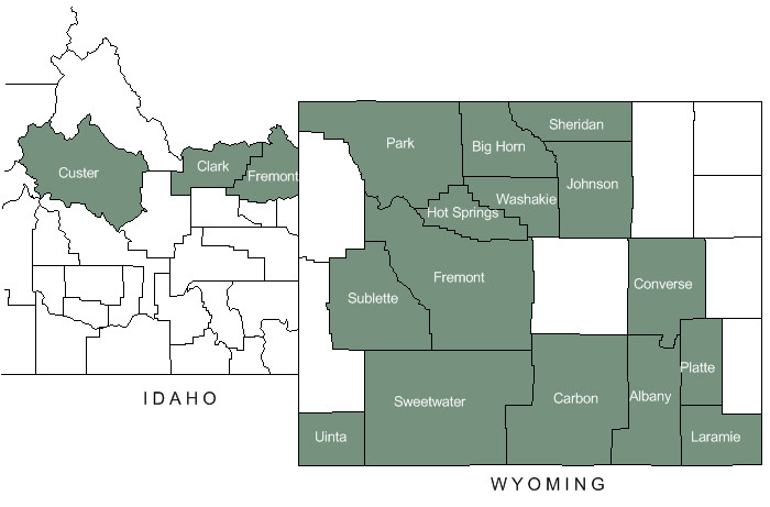
In the fall of 2024, Terra GIS acquired Greenwood Mapping Inc., including its open-source-based web mapping platform. Terra GIS now hosts all interactive Web Maps previously supported by Richard Greenwood, including those used by county governments in Wyoming and Idaho.
 
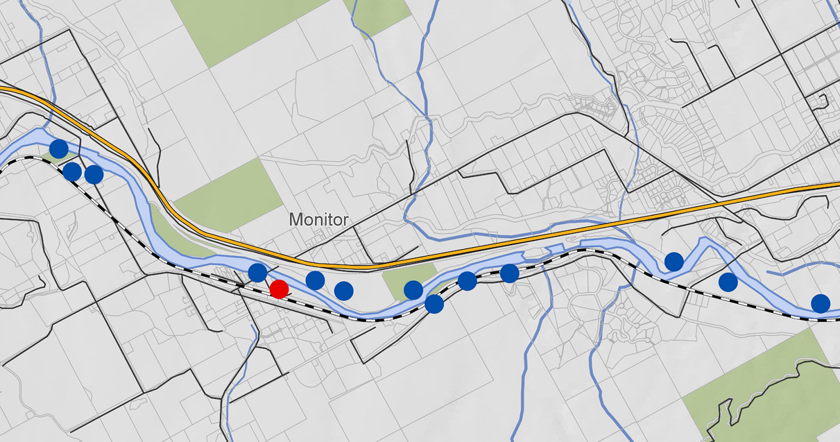
Click on the map below to open the respective web map application in a new browser tab.
 
Map of counties
Custer Clark Fremont Hot Springs Uinta Washakie Sheridan Laramie Big Horn Johnson Converse Albany Sublette Park Carbon Fremont Sweetwater Platte Teton

Data

These applications integrate multiple sources of public data, including:

  • GIS – parcel mapping and 911 addressing
  • Clerk – scanned and indexed land records
  • Assessor – property details and valuations
  • Treasurer – tax history and online payments

Property Tax Map Services

Land Records Access

Remote Sensing with Free and Open Source Software (FOSS): Land Cover Analysis – Live Online workshop

On April 22nd Terra GIS is offering a half-day workshop as part of the GIS in Action (virtual) Conference 2021

Remote sensing with FOSS

Remote Sensing with Free and Open Source Software (FOSS): Land Cover Analysis
Discover the powerful capabilities that Free and Open Source Software (FOSS)[1] has to offer for remote sensing tasks and beyond. This 4-hour workshop will demonstrate how to perform a land cover analysis using Sentinel 2 imagery using two different approaches.
Details about the workshop can be found here.
Registration page for the workshop.

Remote Sensing with Free and Open Source Software (FOSS): Land Cover Analysis

Discover the powerful capabilities that Free and Open Source Software (FOSS)[1] has to offer for remote sensing tasks and beyond. This 4-hour workshop will demonstrate how to perform a land cover analysis using Sentinel 2 imagery[2] using two different approaches.

Remote sensing with FOSS

Participants are welcome to follow along with the workflow on their own machines if desired. Examples will include both the use of “Maximum Likelihood” and “Random Forest” classification algorithms. The first approach will show how to do a land cover analysis on QGIS desktop (on windows), while the second approach covers how to use the Google Earth Engine platform(GEE) [5] (a cloud-computing-platform based earth analysis engine) to do the same.

A brief overview of FOSS for remote sensing will be followed by an introduction to QGIS desktop[3] and the Semi-automatic Classification Plug-in (SCP)[4]. This covers a complete workflow of performing a land cover analysis in QGIS based on Sentinel 2 imagery at 10-meter resolution. Steps covered in this workflow include:

  • Selecting and obtaining imagery (direct queries, filtering of areas and imagery parameters, and download directly via the GUI in QGIS)
  • Creating a suitable band set for the land cover analysis depending on the satellite/imagery used
  • Preprocessing, conversion to reflectance, and simple atmospheric correction of imagery bands
  • Creating training areas for the land cover classification
  • performing the land cover classification (Maximum Likelihood vs. Random Forest)
  • A brief overview of post-processing capabilities
  • Accuracy assessment and error correction

The second approach shows the use of the Google Earth Engine platform (GEE) [5] to perform a similar analysis. The use of GEE is free for academic and private purposes. Following the workflow of the first approach example scripts will be illustrated on how to run a Random Forest-based land cover analysis on a time series of sentinel 2 and sentinel 1 imagery.

In summary, the workshop will include the following parts

  1. Overview of FOSS for remote sensing tasks
  2. Land Cover Analysis using QGIS and the SCP plug-in
    1. Brief Overview of QGIS desktop
    2. Overview of the SCP (Semi-automatic classification) plug-in
    3. Land Cover Classification using the SCP
  3. The GOOGLE Earth Engine(GEE) Platform
    1. Brief Overview of (GEE)
    2. Land cover Classification using GEE

[1] Free and Open Source Software
[2] The Sentinel program is part of the Copernicus initiative of the ESA
[3] QGIS project
[4] Semi-automatic Classification Plug-in (SCP)
[5]  Google Earth Engine (GEE)

Practical QGIS – Live Online Class December 7th through 9th, 2020

Learn QGIS

On December 7th through 9th Terra GIS is offering a 3 day online class on QGIS Desktop GIS ( taught live out of, Seattle, Washington). The class will focus on practical exercises in a workshop style setting. The class will enable ArcGIS users to easily transition to using QGIS and its comprehensive tool kit (or to use it in addition to their existing GIS software). Participants can choose to attend the full three days of the class or optionally attend only one or two of the days. Details about the class can to be found here.

Practical QGIS – Live Online Class May 26 through 28th, 2020

Learn QGIS

On May 26 through 28th Terra GIS is offering a 3 day online class on QGIS Desktop GIS ( taught live out of, Seattle, Washington). The class will focus on practical exercises in a workshop style setting. The class will enable ArcGIS users to easily transition to using QGIS and its comprehensive tool kit (or to use it in addition to their existing GIS software). Participants can choose to attend the full three days of the class or optionally attend only one or two of the days. Details about the class can to be found here.