Discover the powerful capabilities that Free and Open Source Software (FOSS)[1] has to offer for remote sensing tasks and beyond. This 4-hour workshop will demonstrate how to perform a land cover analysis using Sentinel 2 imagery[2] using two different approaches.
Participants are welcome to follow along with the workflow on their own machines if desired. Examples will include both the use of “Maximum Likelihood” and “Random Forest” classification algorithms. The first approach will show how to do a land cover analysis on QGIS desktop (on windows), while the second approach covers how to use the Google Earth Engine platform(GEE) [5] (a cloud-computing-platform based earth analysis engine) to do the same.
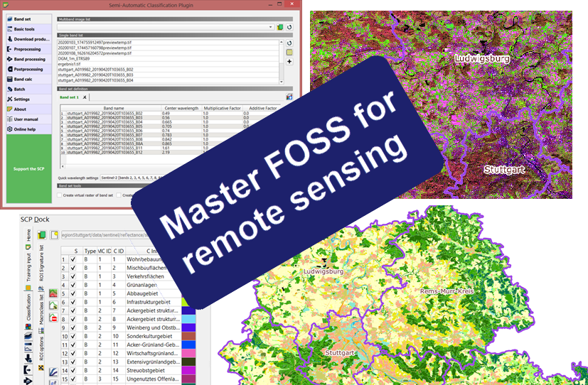
A brief overview of FOSS for remote sensing will be followed by an introduction to QGIS desktop[3] and the Semi-automatic Classification Plug-in (SCP)[4]. This covers a complete workflow of performing a land cover analysis in QGIS based on Sentinel 2 imagery at 10-meter resolution. Steps covered in this workflow include:
- Selecting and obtaining imagery (direct queries, filtering of areas and imagery parameters, and download directly via the GUI in QGIS)
- Creating a suitable band set for the land cover analysis depending on the satellite/imagery used
- Preprocessing, conversion to reflectance, and simple atmospheric correction of imagery bands
- Creating training areas for the land cover classification
- performing the land cover classification (Maximum Likelihood vs. Random Forest)
- A brief overview of post-processing capabilities
- Accuracy assessment and error correction
The second approach shows the use of the Google Earth Engine platform (GEE) [5] to perform a similar analysis. The use of GEE is free for academic and private purposes. Following the workflow of the first approach example scripts will be illustrated on how to run a Random Forest-based land cover analysis on a time series of sentinel 2 and sentinel 1 imagery.
In summary, the workshop will include the following parts
- Overview of FOSS for remote sensing tasks
- Land Cover Analysis using QGIS and the SCP plug-in
- Brief Overview of QGIS desktop
- Overview of the SCP (Semi-automatic classification) plug-in
- Land Cover Classification using the SCP
- The GOOGLE Earth Engine(GEE) Platform
- Brief Overview of (GEE)
- Land cover Classification using GEE
[1] Free and Open Source Software
[2] The Sentinel program is part of the Copernicus initiative of the ESA
[3] QGIS project
[4] Semi-automatic Classification Plug-in (SCP)
[5] Google Earth Engine (GEE)