 Terra GIS and the gvSIG Association signed an agreement of collaboration. The work of the Association and its collaborators aims at promoting the use of open source geospatial solutions and is not limited to gvSIG products. Terra GIS has the immediate goal to provide enhanced recources to open source gis users such as training and support services along with easy access to documentation and tutorials. The growing list of collaborators of the gvSIG association can be found here.
Category: news
Open Source Desktop GIS Workshop at WAURISA 2010
TerraGIS will be presenting a half day “pre-conference” workshop on April 19th 2010 at the WAURISA 2010 conference. This years slogan is “rise to the challenge”. The conference is held from April 19th-21th, 2010 in the Greater Tacoma Convention & Trade Center , 1500 Broadway, Tacoma, Washington, USA.
 This time I will be talking about “Open Source Tools for Spatial Analysis and Geoprocessing on the Desktop“. A general introduction and overview about the tools covered in this workshop will be followed by examples illustrating the use of desktop utilities based on the OGR/GDAL2 libraries, PostGIS (“the” open source spatial database) and gvSIG (a desktop GIS) for spatial analysis and geoprocessing. During the workshop participants can use a live DVD with their own laptop to go along with some of the exercises. Continue reading “Open Source Desktop GIS Workshop at WAURISA 2010”
Obama Campaign – Mapping voters with Mapserver, PostGIS and Openlayers
US Presidential Election 08
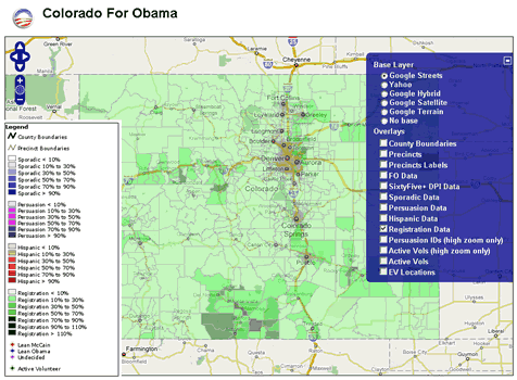
Some months ago I was lucky enough to secure a couple of small contracts with the Obama for America Campaign  to support their general effort and the work of the field organizers by implementing some web mapping capabilities. After some phone discussions with the Obama Technology team it actually was not hard to convince them to go the open source route and setup a server on Amazon EC2. We took an existing Ubuntu-based server image that included most of the Open Source GIS stack already (many thanks to Josh Livni of Umbrella Consulting who created the public image and who also has instructions on his website on how to set this up quickly: http://os.umbrellaconsulting.com/wiki/AmazonEC2). Continue reading “Obama Campaign – Mapping voters with Mapserver, PostGIS and Openlayers”
The Trust for Public Land publishes “Wenatchee Watershed Vision” Report
TPL’s Northwest Regional Office recently published “The Wenatchee Watershed Vision” including maps by Karsten Vennemann of Terra GIS. The report was completed in September 2007 and is a conservation vision plan for the Wenatchee River Watershed. The main focus is on the areas stretching from Leavenworth to Wenatchee. It is intended to serve as inspiration for community action, fostering coalitions, strategic partnerships and cooperation among local government agencies, and public and private entities in the area. Continue reading “The Trust for Public Land publishes “Wenatchee Watershed Vision” Report”