In today’s presentation at King County GIS Center User Group meeting (Seattle, WA, USA) I talked about two powerful free & Open source extensions for ArcGIS. Both of them were released in late 2011: SpatialKit for ArcMap and SEXTANTE for ArcGIS. These extensions offer functionality that is not available at the ArcView level to ArcGIS license owners. This talk will present the extensions and demonstrate many of their tools.
 SpatialKit for ArcMap enables users to use PostGIS data directly in ArcGIS. This means that ArcGIS users can employ the power of the first-class, open source spatial database PostGIS in the same way they use proprietary databases to store, edit and retrieve spatial features via ArcSDE. SpatialKit for ArcMap does not require ArcSDE, ArcInfo, the new Spatial Data Server (SDS) technology, or ArcGIS server.
![]()
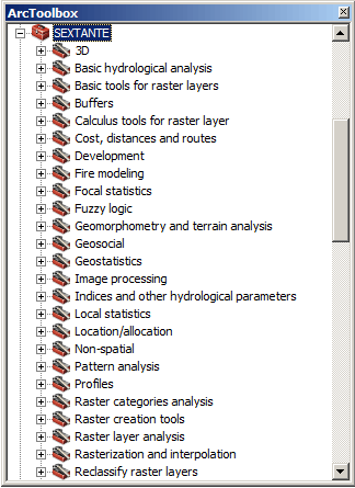
SEXTANTE is a spatial data analysis library written in Java. The SEXTANTE for ArcGIS extension makes it possible to use SEXTANTE (and SAGA GIS) tools directly in ArcGIS, including Model Builder. Together SEXTANTE and SAGA comprise hundreds of spatial analysis functions, including many that are otherwise available in ArcGIS only through proprietary extensions that require additional licenses, such as Spatial Analyst.
 gvSIG CE was presented as a powerful Desktop GIS and at the same time a great alternative to use Sextante integrated with the Grass, and Saga GIS algorithms (Grass algorithms are not available for the ArcGIS extensions at the time of writing). In the near future a version of Sextante will be released that in addition integrates the use of R (Statistical package) algorithms from within Sextante.
downloads
presentation slides (PDF)
zip archive with the 2 extension software packages , documentation and all (45 MB)
external links
Spatial Kit for ArcMap
SEXTANTE
SEXTANTE for ArcGIS
gvSIG CE