| Click on the small map images on the left to view each chapter. | ||
| Cartography and Analysis | ||
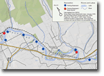 |
In this section you can find examples of projects that involved the creation of maps and analysis and /or modeling efforts. | |
| Web Mapping Applications | ||
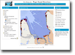 |
Interactive Web maps and information systems are a great tool for visualization and planning. They can be used to
|
|
| Spatial Tools | ||
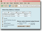 |
Custom built spatial tools can add a whole new world of efficiency to many tasks. These applications are all about building efficiencies and capacity in your organization. | |